
One of my favorite things to happen on a chase is to make a forecast, drive to the target area, and then observe the storm form. That’s what happened with teh chase on 26 May, 2015!
Started the day at Fort Worth, generally targeting the region between Abilene and Wichita Falls, TX. Headed west on I-20 and north on 183 at Cisco. As we approached Breckenridge, TX, we could see cumulus congestus building to the NE . The early precip from this development is visible on the Fort Worth radar at 1916z (3:16 pm CDT). Note there are no radar echos near Breckenridge….

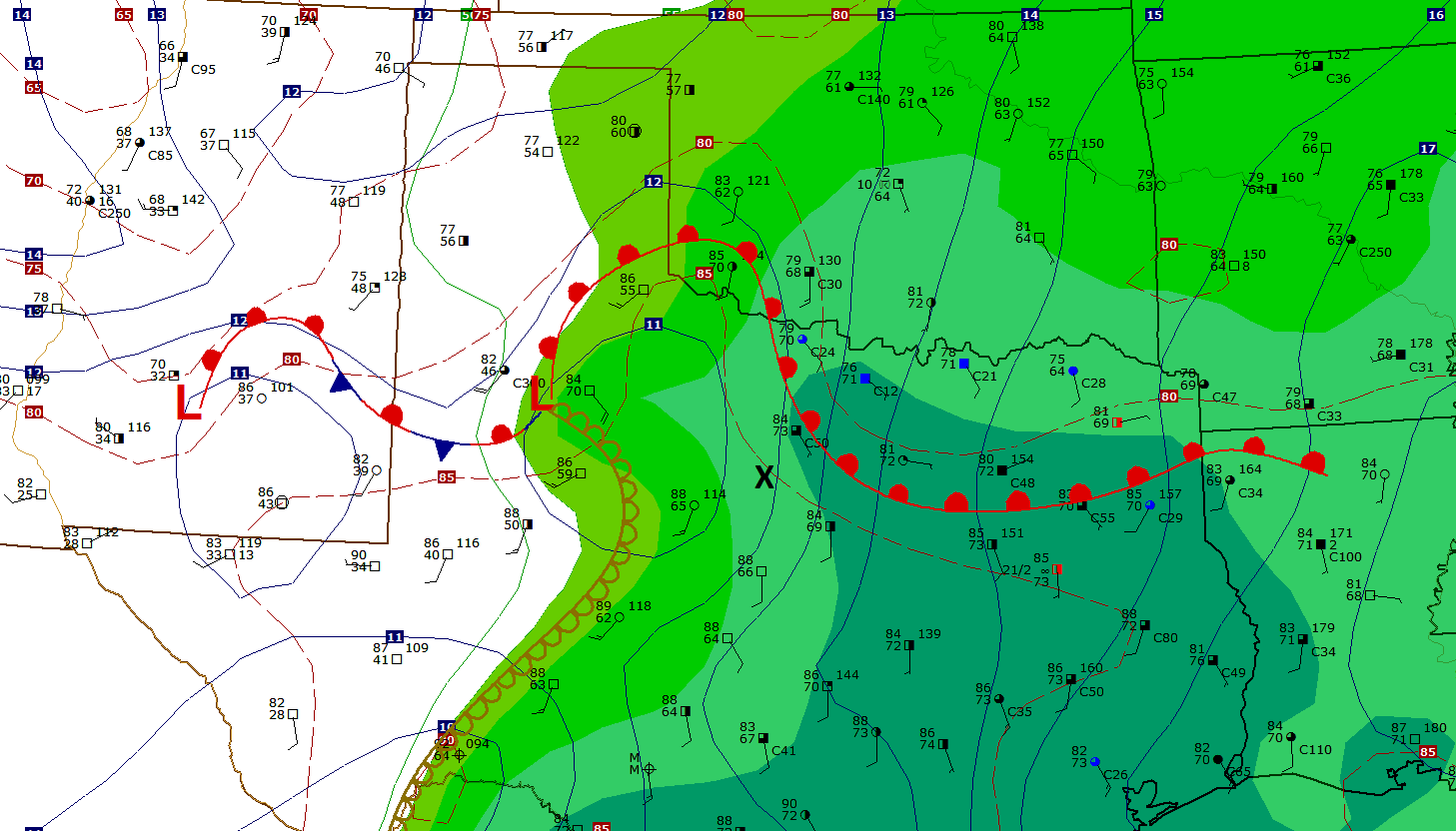
We drove through the centre of Breckenridge, a town of around 5,000 (but because this is Texas it has a 10 story building at the main intersection of ‘downtown’), and stopped at a drive-thru Liquor Store at the north end of town to check data. I’ve pulled some archived data (all valid at 2000z, or 4:00 pm CDT)
A tongue of high instability was evident in NW Texas, with ML CAPE > 4000 j/kg:

Bulk shear was not huge, but in the range for supercells – but not as much as one might want to keep the precip core separated from the updraft. That would suggest a quick transition ti High Precipitation supercells (often the case on the Southern Plains in 2015):

And there were steep low and mid level lapse rates in place over NW Texas (and Oklahoma):

The ‘X’ on the 20z mesoscale surface analysis depicts where Doug and I were located , just west of the surface moist axis and SW of the thermal boundary:
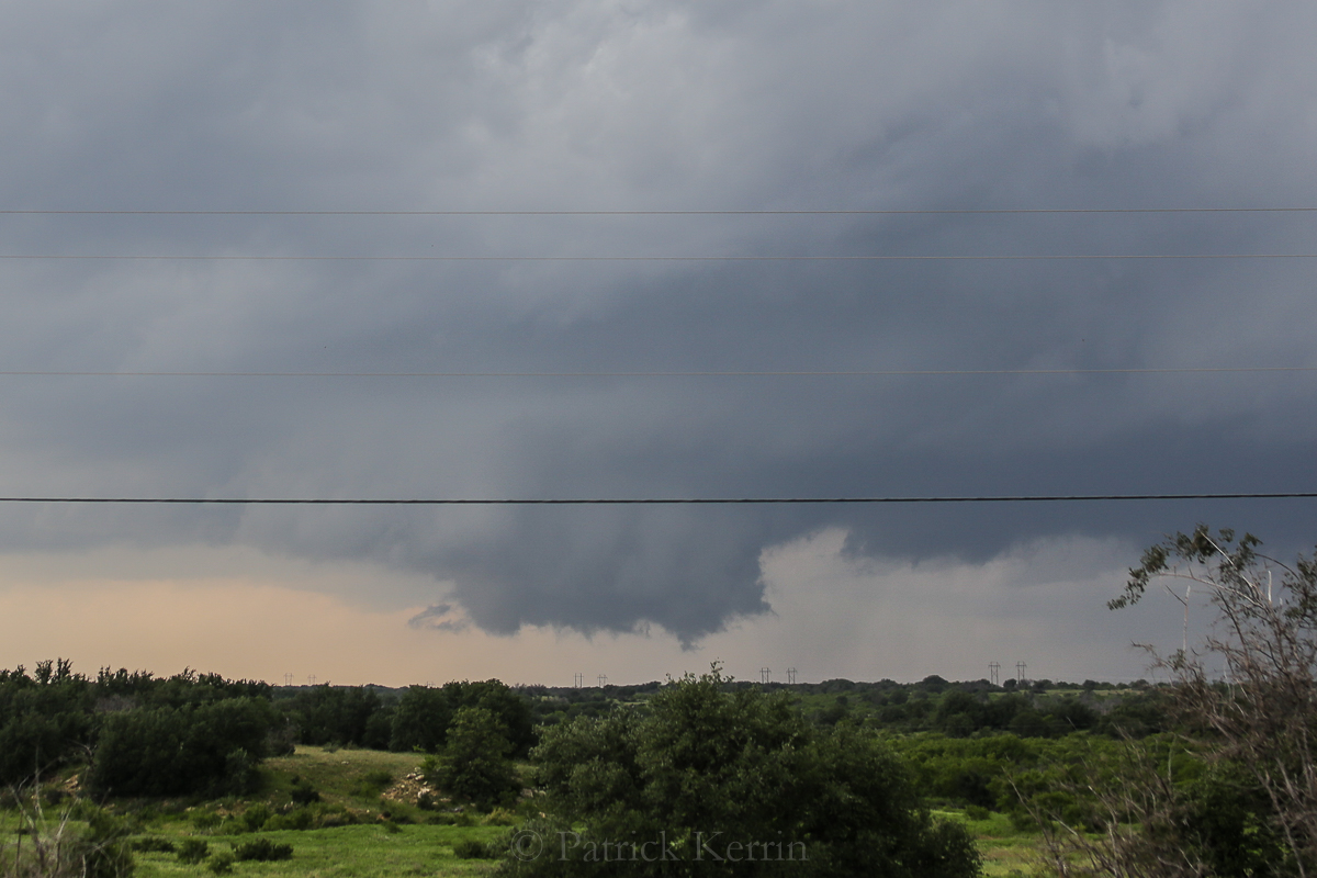
We noticed explosive convective development NW of Breckenridge and wen back into town to head west, and pulled into the Walmart paring lot which gave us a good view of the developing updraft. This picture was taken right at 20z: (4:00 pm)

Anvil developed almost instantaneously with knuckles/mammatus:


Fort Worth had already issued a Tornado Warning for this storm, fifteen minutes before the above radar image – so from no reflectivity to Tornado Warned supercell in a half-an-hour!

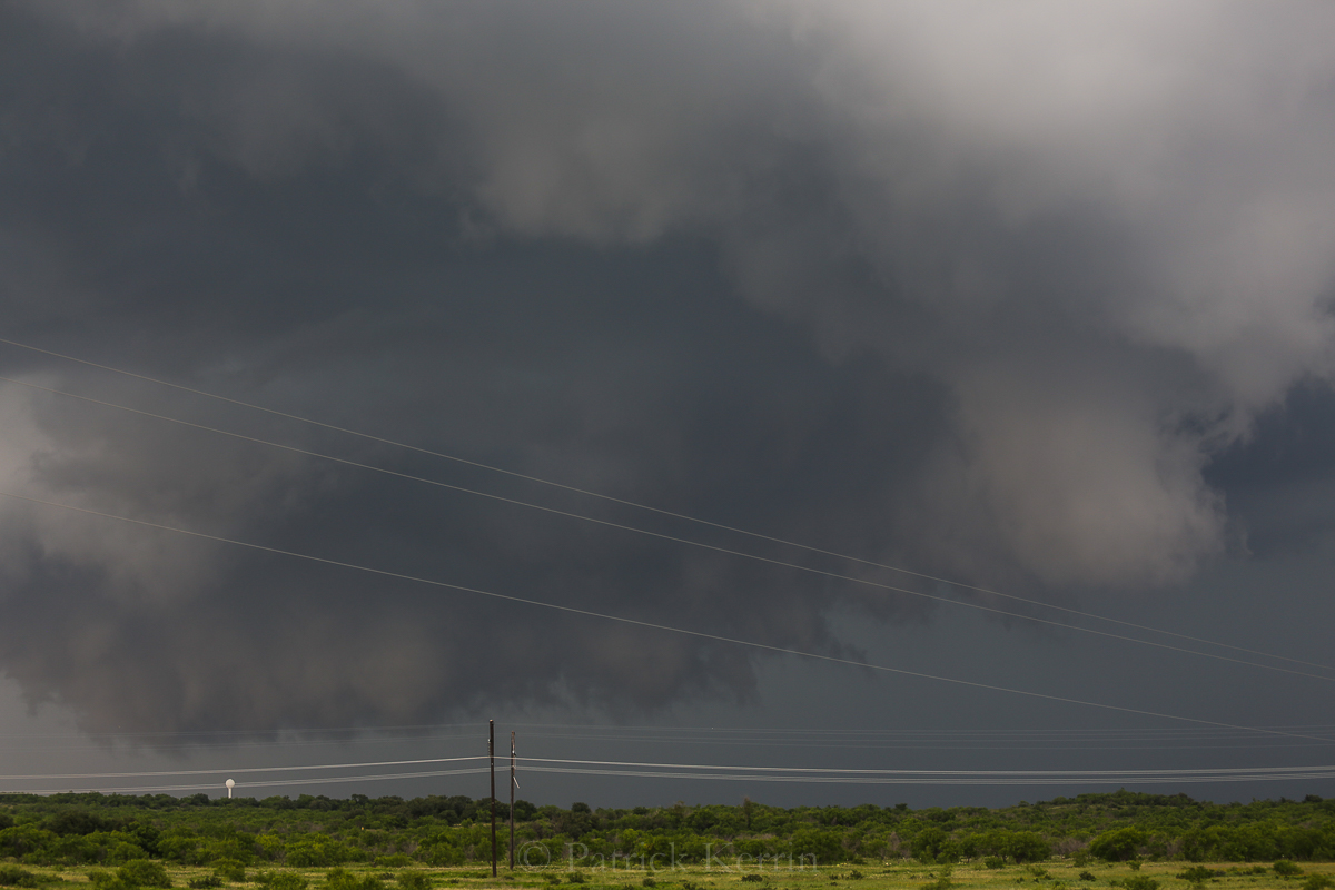
Decided to head east out of town ad was able to keep the updraft in sight. I was able to take a series of images while Doug drove (all hand-held while moving) with the 70-200 F4 IS. Here is a nice blocky wall cloud (this sequence of images start at 2029z – 4:29 pm):
Interesting interaction of the RFD with the wall cloud in this sequence.


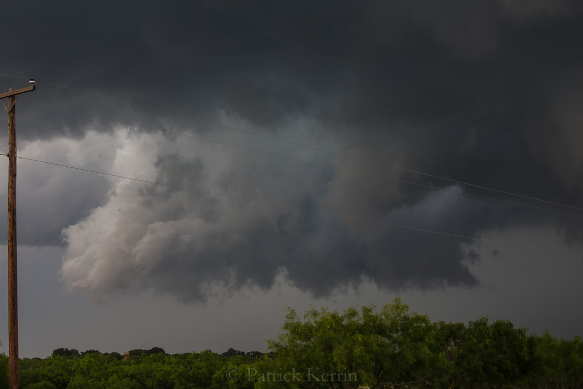
We got to the intersection of 67 and 180 and were able to finally find a spot to pull over that had a decent view! Again the updraft and RFD cut (2101z / 5:01 pm):

We were about a mile up 67, looking NE. Reflectivity showed a little hook WSW if Ivan, TX which correlates to what we were seeing:

Lowering on the left side of the wall could became more prominent, but showed no clear-cut evidence of rotation at the surface:

Corresponding Storm Relative Velocity couplet:

Very nice laminar structure as the RFD cuts into the wall cloud


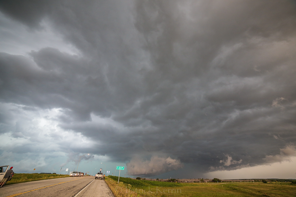
Unfortunately, this was not a discrete supercell, but was part of a group of storm that has split and developed to the north and east.
Good paved roads were few and far between and the region to the east of Breckenridge has a lot of hilly terrain (like the Hill Country near Austin, TX in places).
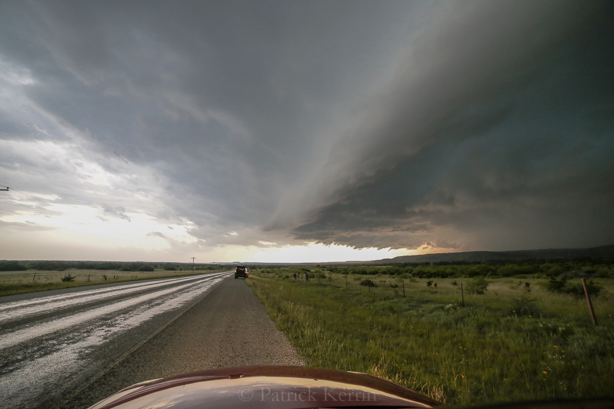
We moved east and could not get to the updrafts that produced the tornado up near Possum Kingdom lake. We positioned ourselves ahead of the convection that now had developed a nice arcus structure.

Stitched Panorama:

These images were from 16, just south of 180.

Another stitched pano:

Here is the ‘bug-splatter’ reflectivity (term coined by Steve Miller!):

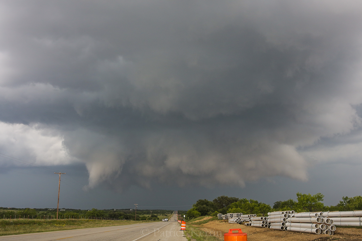
Pano of the Whales’ Mouth:

Wide angle trough the moonroof:
We moved down 16 to Interstate 20 – looking north.

Shelfy outflow-dominant lowing:
Other chasers (or maybe they were locals) showed up.

They thought it would be smart to stand up and watch in the the back of the truck (note higher ground on the other side of the overpass, if they really wanted it).

We scooted east on I-20 and then down FR 108 towards Stephenville – more outflow-ness:

I would have liked us to get to Abilene to spend the night, but our storm had blown up into a big mess full of hail so we stayed south. Noticed some very nice mammatus between Hico and Meridian, but couldn’t find a place to stop and safely set up the tripod. By the time we got to Meridian we pulled over safely and I was able to quickly get this image with the window clamp (the mammatus were not as good as earlier).

Video to follow!