Started the day in Denver. Realized there wouldn’t be a lot of time to forecast, and would have to hit the road early!
After a very quick look at things I posted the following rough forecast target to a group of friends:
Best combo of backed sfc flow, ground relative shear (and thus storm relative shear) and decent instability progged in the Sundance, WY – Broadus region. Probably leaving Denver soon and possibly reassess at Lusk.
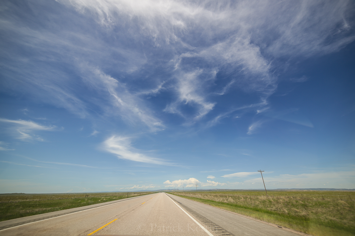
Continued north from Lusk, Wyoming, which brought us through the absolutely beautiful (if you like wide open spaces like I do!) Thunder Basin National Grassland:
As we approached NE Wyoming cumulus started to develop. This was to our NE:

And this, more vigorous convection to our WSW. It’s a trade off having a moonroof in a chase vehicle – you have to be extra cautious to stay out of hail, but it also allows the passenger to capture images out of the roof while moving:

We stopped just outside of Belle Fourche, SD, and went a little west but it was clear that convection occurring there was weak and falling apart rapidly.

We decided to jump on the storm to the SE, near the Black Hills (where Mt. Rushmore is located). We got on I-90 and it was clear that we would have to core punch if we wanted to continue on the freeway past Sturgis, SD (where the annual motorcycle rally is held). So I plotted a alternate route that took us S out of Sturgis to Nemo, SD and then on to Rapid City (see radar image below for relative locations), effectively skirting the now supercell and hopefully getting us in a prime viewing location. This route meant a drive into/through the Black Hills, with very little opportunities to see the storm and mostly just trees and hills and winding 35mph speed limit roads (see timelapse video below that show part of that journey). But because the storm was nearly stationary the strategy worked!
Radar at 2355,z June 1st:

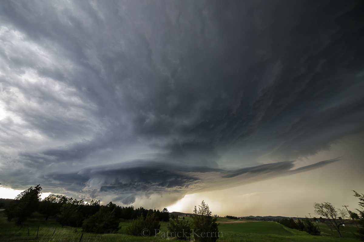
Our first viewing location of the cell, just NW of Rapid City – we encountered no other chasers at this location:

A stitched pano offers a slightly different perspective:

Another pano:

Here is an analysis of surface data at roughly the same time as the above image with the region near Rapid City circled. Dewpoints in the low 60s and a generally backed flow was in place, with a surface low in SE Montana:

Here is the archived observedSkew T and hodograph, also at 00z 2 June.
Of interest is the moderate buoyancy (roughly 2000 j/kg CAPE), and significant low and mid level lapse rates. The 0-6 km shear is weak but if one considers the 35 kt WSW flow at 350mb, and the fact that Rapid City’s elevation puts the surface at 900mb, the shear is well into the supercell range.
I should be noted that the balloon launch is from the weather office which is located a little south of downtown Rapid, City. As the following images and video show, there was significant, low level flow into the cell from what appeared to from be roughly 75 – 80 degrees, which would change the shape of the hodograph to a more markedly broad loop, and would also increase calculated parameters that depend on low level for direction and velocity. The overall ground to 7.5 km shear vector is also increased with the surface flow in the near-storm environment.

We spend a few minutes attempting to find a better viewing location (shown in the video) and found a side road not too far from our original location (still NW of Rapid City) Here is a stitched pano from the new location (we still had not encountered any other chasers):

Here is a wide angle view with the Samyang 14mm:

And the 0032z Reflectivity, which roughly matches the image above (within a few minutes). It is important to note that the rotating updraft does not have heavy precip falling out of it – that is happening to the north What that means is the beautiful updraft is actually located slightly south of the red/purple hook appendage in the reflectivity image – roughly west of the town of Blackhawk on the radar image (the direction I was pointing the camera at for these images shifted from WNW to W to WSW during the time we watched the storm NW of Rapid City):

More wide angle images – note growth of the inflow tail:

The storm was moving roughly SSW at about mph!
Doug Glennie on a supercell:

Stitched Panorama emphasizing the still growing inflow tail – cloud based SR inflow certainly from less that 90 degrees (again, broadening the hodograph):

A structural pinnacle!

0110z reflectivity within a few minutes of the image above:

Other chasers had been around us for some period at this point. Most came and moved we stayed in this spot for roughly 50 minutes. At this point a sub-cloud inflow jet formed with scud rising to cloud base:

Tail evolution continued, with more/heavier precip being drawn around the updraft:

Then there was a relatively rapid evolution with precip falling in close proximity of north side of the updraft (a slow ‘cascade’, see video below):

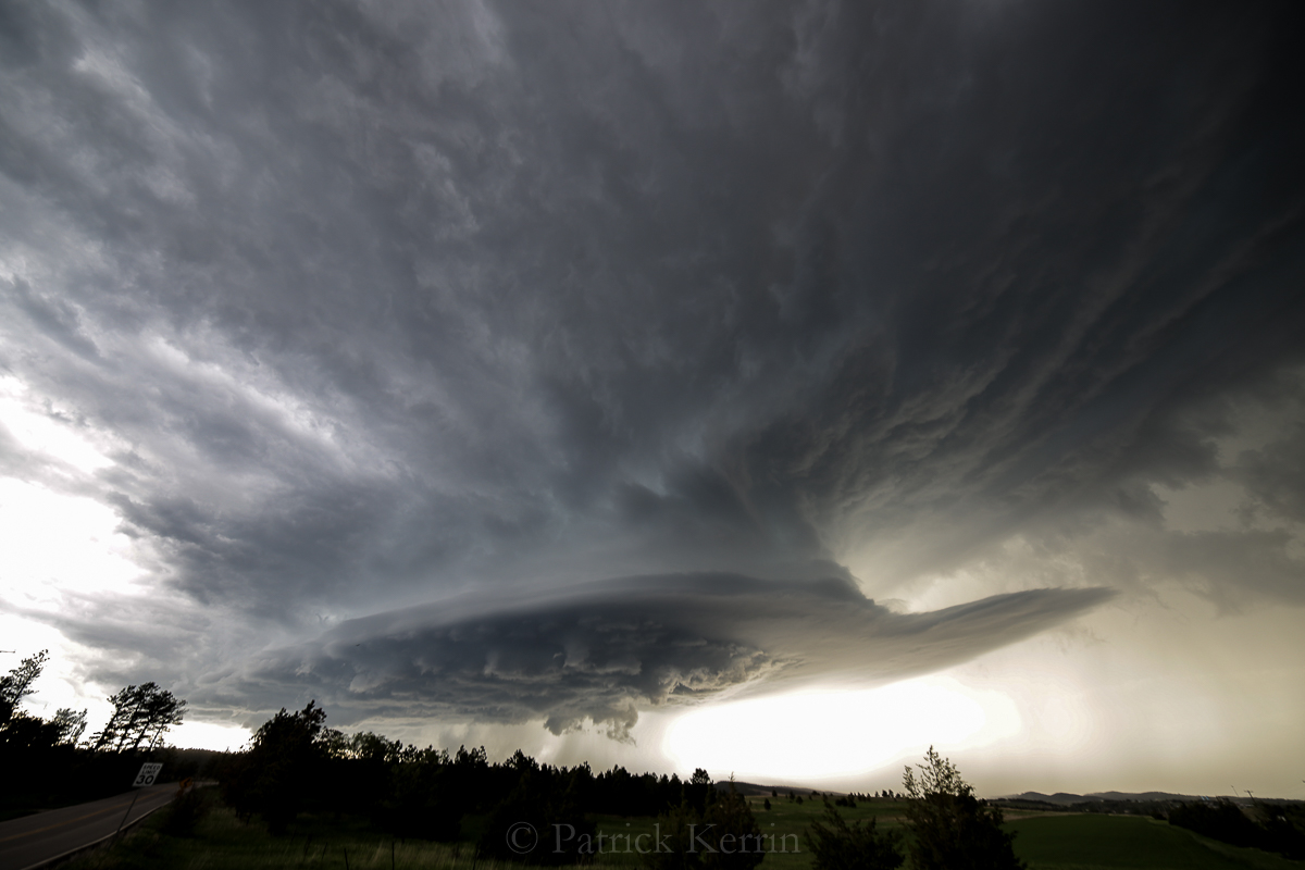
We started repositioning south through Rapid City, with the updraft evolving to where the waning mesocyclone exhibited a beautiful shelf-like structure. Cropped view with the Samyang 14mm:

Wide view:

Another crop of the laminar collar-like structure:

Elevated spot SW of town (location). Setting sun made for a beautiful scene with the weakening supercell.

Handheld lightning! Cropped:

Handheld lightning 2! Cropped:

0200z reflectivity, roughly the same time as the images above:

Great scene to end the day!

Time lapse video:
What a fun chase!